| Start Point | Elevation m (ft) | End Point | Elevation m (ft) | Highest Point m | Distance in Km |
| Jakar town | 2610 (8560) | Gaytsha | 2950 (9680) | Kiki la – 2870 | 27 km |
| Gaytsha | 2950 (9680) | Trongsa | 2150 (7050) | Yotong la – 3434 | 41 km |
| Trongsa | 2150 (7050) | Chendebji | 2430 (7970) | Chendebji – 2440 | 43 km |
| Chendebji | 2430 (7970) | Wangdue Phodrang | 1200 (3940) | Pele la – 3430 | 87 km |
| Wangdue Phodrang | 1200 (3940) | Thimphu | 2330(7640) | Dochula – 3150 | 70 km |
Bhutan Cycling Tour Package
Cycling in Bhutan
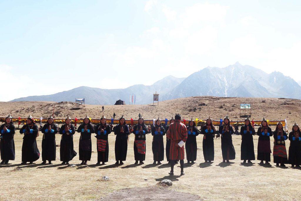
Bhutan is a very beautiful place for out door touring on Motor Bikes and Bicycles. The sky is clear, air is pure and clean and the trails and roads are winding, passing through wilderness and blissful nature all around. Bhutan Jewel Travel Operate such tours so that the adventurous and nature loving tourists can enjoy their time in Bhutan.
Bhutan Tour Of The Dragon Bike Race
Participants who want to join the infamous World’s Toughest and most stunning ONE DAY Mountain Bike Race can contact us and we will make arrangements for your participation. The annual Race is always held on the first Sunday of September.
From 2015 a shorter distance Race has been included which is of 60 Kms called the Dragon’s Fury Bike Race.
#BhutanCyclingRace #BhutanTouroftheDragonRace
Participants can Register right here for the World’s Toughest ONE DAY Mountain Bike Race called the Tour of The Dragon and Dragon’s Fury.
ABOUT THE RACE:
The Tour of the Dragon is a ONE DAY 268km mile mountain bike race staged on mountain roads in the majestic inner Himalayas of the Buddhist country of Bhutan. It is the hardest one day mountain bike race in the world. It travels 268 Kilometers Across 4 High Mountain Passes ranging from 1200 meters to 3340 meters.
RACE ROUTE INFORMATION:
The races starts in Bumthang, central Bhutan (2610m, 8560 ft). The riders follow the Bumthang chhu (river in Dzongkha) for a couple of kilometers and then climb 6km through blue pine forest to Kiki La at 2870m (9420 ft). From there it is down to Nangar. Through more blue pine forest and agricultural land you follow a gentle road through Chumey and up to Gaytsha (2950m, 9680ft).
The road then climbs 7km up through blue pine forest to Bong Bridge and then gets a little steeper for about 5km through mixed conifer and rhododendron forests and pastures till you reach Yotongla at 3430m (11250 ft). From Yotongla it is a 29 km downhill ride to Trongsa. The pass is dominated by fir and rhododendron forest, open pastures and rock outcrops. As you go down to Dorji Gonpa, which is almost halfway, firs give way to spruce and hemlock and mixed broad leaved forest dominated by birch and oaks and rhododendrons. Below Dorji Gonpa, the road passes though broad leaved forests and agricultural fields. There are some excellent viewpoints to see Trongsa, the Dzong and the extensive forests and agricultural fields beyond. Just before reaching Trongsa (2150m, 7050ft) you pass right below the Ta Dzong (a watchtower to guard the dzong from enemies).
From Trongsa the road descents gently for 7km to the Bjee Zam bridge at 1900m (6230 ft) and then climbs 6km through broad leaved forests to a view point from where the Trongsa Dzong seems just a stone throw away. The road continues climbing for another 10km along cliffs and through broad leaved forests and agricultural settlements. At Tshangkha it passes the headquarters of the Jigme Singye Wangchuk National Park. After reaching Tashiling, a few km further, most of the climbing is done. For the last 20km you will only climb some 150m (500 ft), but there are some ups and downs. As you near Chendebji, hemlock replaces broad leaved species on some of the ridges and in the valley. You pass Chendebji chorten and a little later will reach Chendebji village (2430m, 7970 ft).
The road climbs through mixed conifer forest past Nikachu bridge at Chazam and Rukubji to the small settlement of Longte. By this time much of the trees have been replaced by pastures and agricultural fields. Through these pastures dominated by dwarf bamboo you reach Pelela (3430m, 11250 ft). You then continue your long descent through fir, birch, rhododendron forest and many small waterfalls to Wangdue Phodrang. After passing the village of Nobding, 12km down, there is a single restaurant a further 12 km down and then a few shops at Teki Zampa another 15km further. Just past here a new Japanese bridge spans the Dang Chhu. After a long almost flat stretch you reach Wangdue Phodrang.
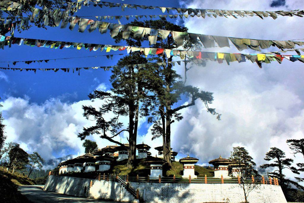
From Wangdue Phodrang, you continue to Metshina, at an altitude of 1410m (4625 ft). From Metshina, the distance to Dochula at 3150m (10,330 ft) is 38.3km and the race is all uphill with an average slope of 5% and a few short sections of up to 10%. You will pass Thinleygang (11 km), Lumitsawa (15km), Lampiri (28km) and a memorial chorten for traffic accident victims (32km). Thinleygang is the only place recognizable as a village, having a couple of shops and a BHU (Basic Health Unit). Racing 1700m (5575 ft) uphill is as breathtaking as the views.
After Dochula, it is all downhill to Thimphu at 2330m (7640 ft) with a small climb only at the end to the clock tower at Thimphu city square.
SUMMARY of the Race Route Elevations: